Cleveland's First Infrastructure:
The Ohio & Erie Canal
Section 2: Planning the Canal
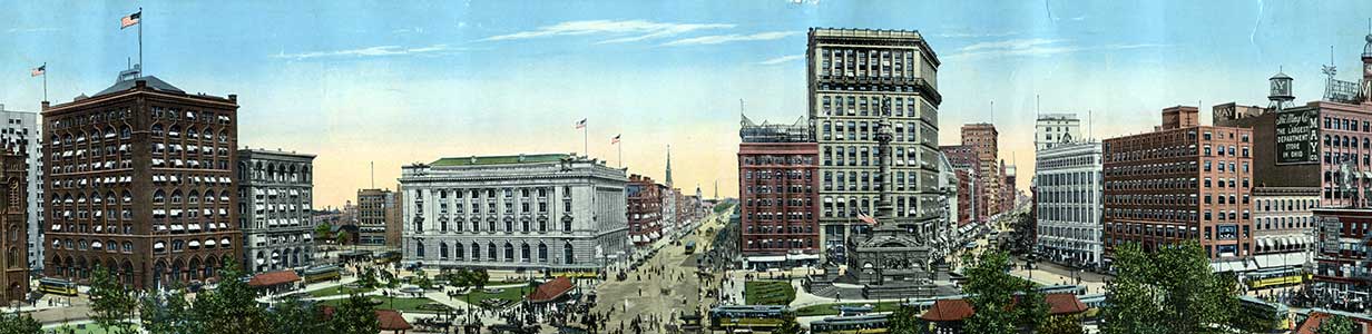
In 1820, only one year after the Erie canal in New York state opened for navigation, Cleveland was a settlement of 606. Ohio had seventeen years of experience at statehood. Much of the state was wilderness, with no reliable system of transportation. The economy was largely based on subsistence agriculture and barter.
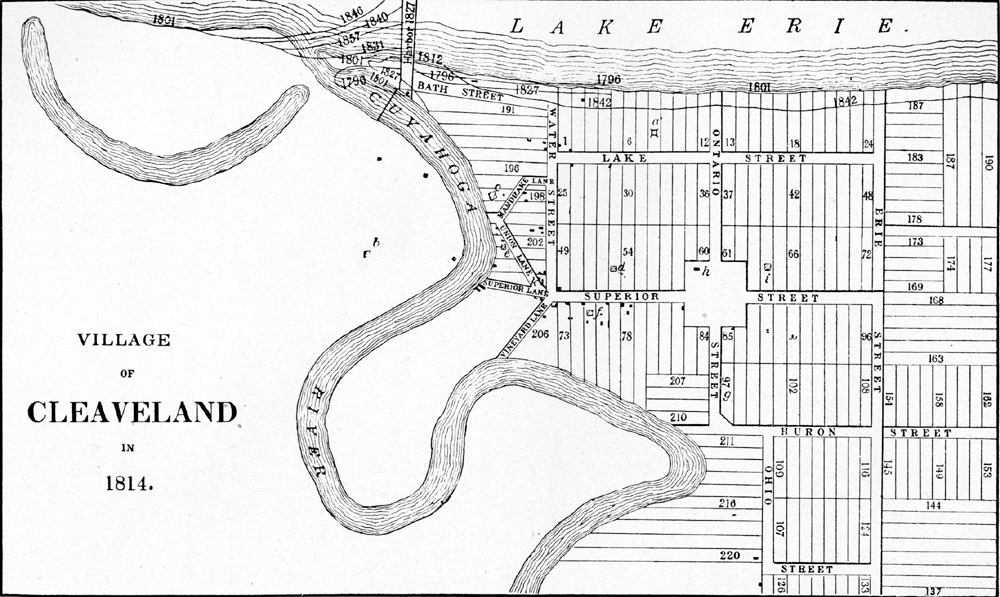
Alfred Kelley's map of Cleveland drawn in 1814 and annotated by Charles Whittlesey. This map was corrected from Amos Spafford's map of 1801, showing the layout of the village.(from A History of Cleveland, Vol. I, by Samuel P. Orth, facing page 98)
The editor of a Cleveland newspaper had this to say about the opening of the Erie canal in 1819:
"The progress of this great work must be viewed with interest, as the advantages it will afford this part of Ohio, as well as the western country generally, cannot fail to have an important influence on the general prosperity. It is said that 90 miles will be fully completed this season."
-- November 16, 1819 (excerpt), cited in Annals of Cleveland Vol. II, page 6, abstract 8-H Nov. 16, ed:3/2.
Over the next several years, the newspapers of Cleveland and rival towns often served as a forum for reports and opinions about the development of a canal system in Ohio.
"We know of no subject at the present time that takes preference to that of the Canal policy, nor any one that holds a stronger connection with the interests of all classes throughout the state. The eye of the most superficial observer of a journal finds employment whenever its importance is spoken of; and there is nothing among the passing news, here or elsewhere, that furnishes equal amusement of instruction... The common field of conversation and profitable inquiry is extended among the old and the young in general, leading to speculative comparisons of the eventual growth of one section, and the decay of another; the concentration of wealth and business in this or that neighborhood, and its consequent decrease in a less favored vicinity, with the essential effect that our home advantages will soon have on common prosperity, all tending to enlarge our acquaintance with the State, to promote a community of feeling among individuals, and more closely connect the social ties and interests of the inhabitants. These are some of the benefits derivable from the Canal policy, in the present incipient stage of its progress, already producing, as a little observation will show, a salutary and wholesome influence, and one which should be every where encouraged."
-- September 5, 1822, cited in Annals of Cleveland Vol. V, page 165, abstract 45-H Sept. 5; ed:3/1,2.
During the Depression of the 1930s, the Historical Records Survey project of the Works Progress Administration (WPA) began to compile a digest and index of early Cleveland newspapers.
Visit Cleveland Memory's Annals of Cleveland: A Depression-Era Project of the WPA to view a compendium of abstracts about canals for the years 1818 through 1835.
Alfred Kelly
As communities throughout the state worked to influence the route of canal development, surveyors were commissioned to determine distances, measure water levels, and calculate costs.
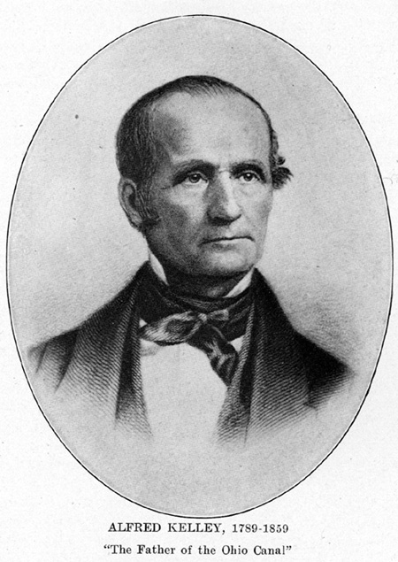
A portrait of Alfred Kelley, Cleveland attorney and acting Canal Commissioner. (from A History of Cleveland, Vol. I, by Samuel P. Orth, page 690)
Among those most responsible for the route of the Ohio & Erie Canal, and for its terminus at the village of Cleveland, was Alfred Kelley. The Cleveland attorney and politician successfully campaigned for the passage of a canal bill, and supervised the construction of the northern section of the canal as acting Canal Commissioner.
Reports of the Canal Commissioners, legislative acts authorizing surveys, governor's messages about the canal, civil engineers' reports, financial reports, and other official documents were compiled by John Kilbourn and included in his periodical publication, "Civil Engineer and Herald of Internal Improvement" beginning on June 21, 1828. These documents were bound under the title: Public Documents, concerning the Ohio Canals, which are to connect Lake Erie with the Ohio River, comprising a complete official history of these great works of internal improvement.
Cleveland's First Infrastructure is a project of Cleveland State University Library Special Collections, and was made possible by a grant from the Cleveland Section of the American Society of Civil Engineers. It seems appropriate that this exhibit, which highlights the achievement of civil engineers of the early 19th century, premiered during National Engineers Week and on the eve of the birthday of military engineer and land surveyor George Washington. We hope that this site will serve as a gateway through which people can learn about the canal, identify resources for further investigation of canal engineering and history, and find opportunities to visit preserved areas of the Ohio & Erie Canal in Ohio.